
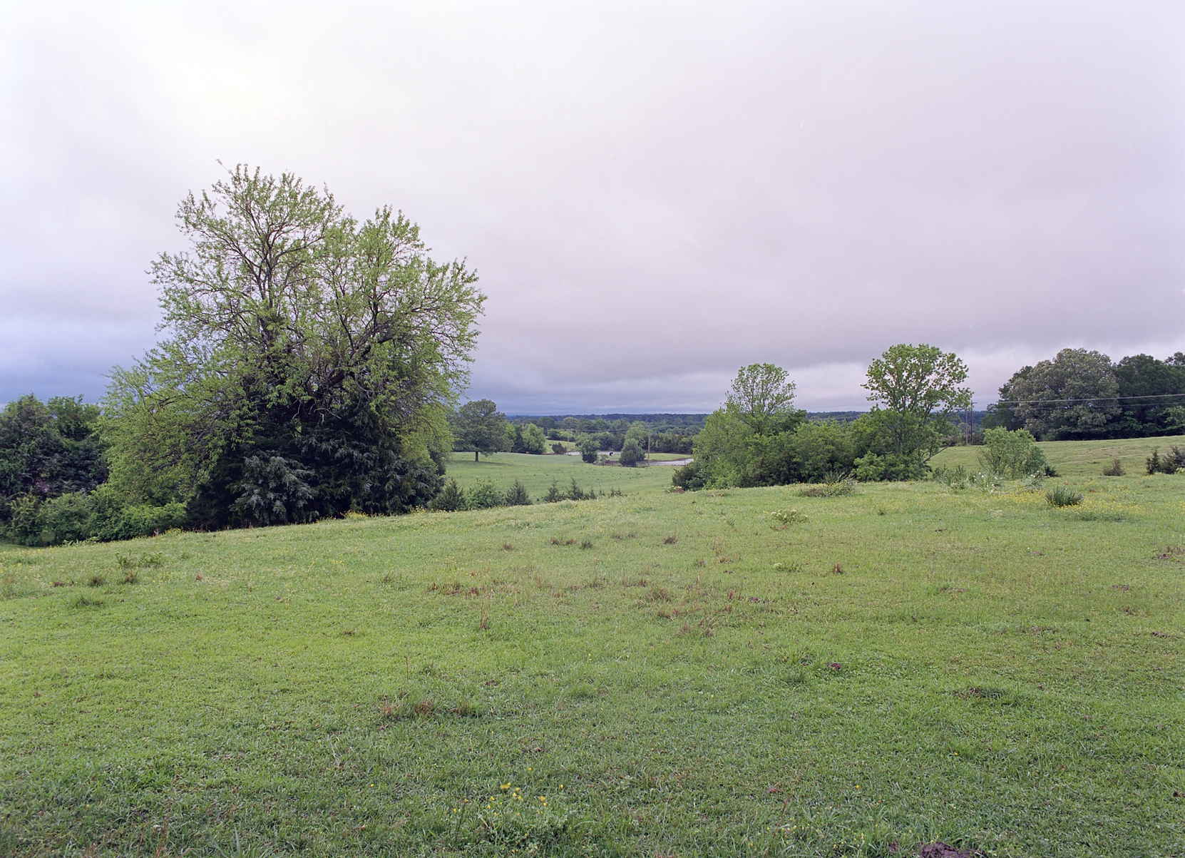
As you reach the end of Mt Vernon road, there's a view off to the north-northeast that is compelling. On clear days you can see the higher hills of Prentiss County, but even on overcast days it's one of the better prospects in Lee County.
Kodak Ektar 100, Pentax 645A with Pentax 45mm f/2.8. This was shot at a half second at f/16.
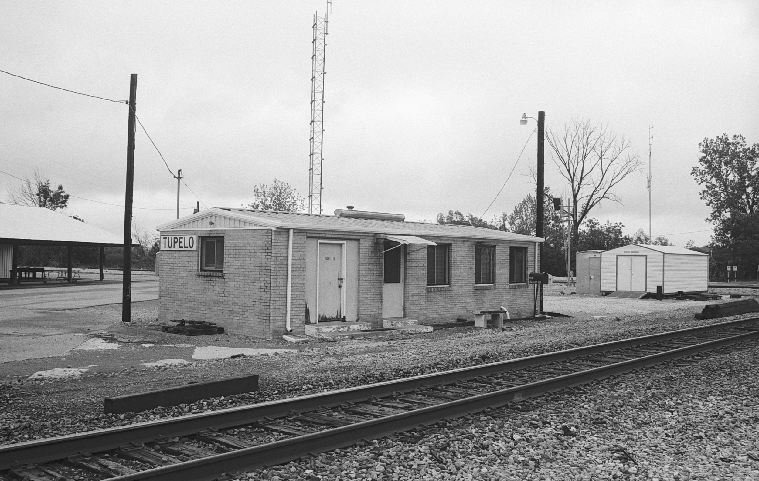
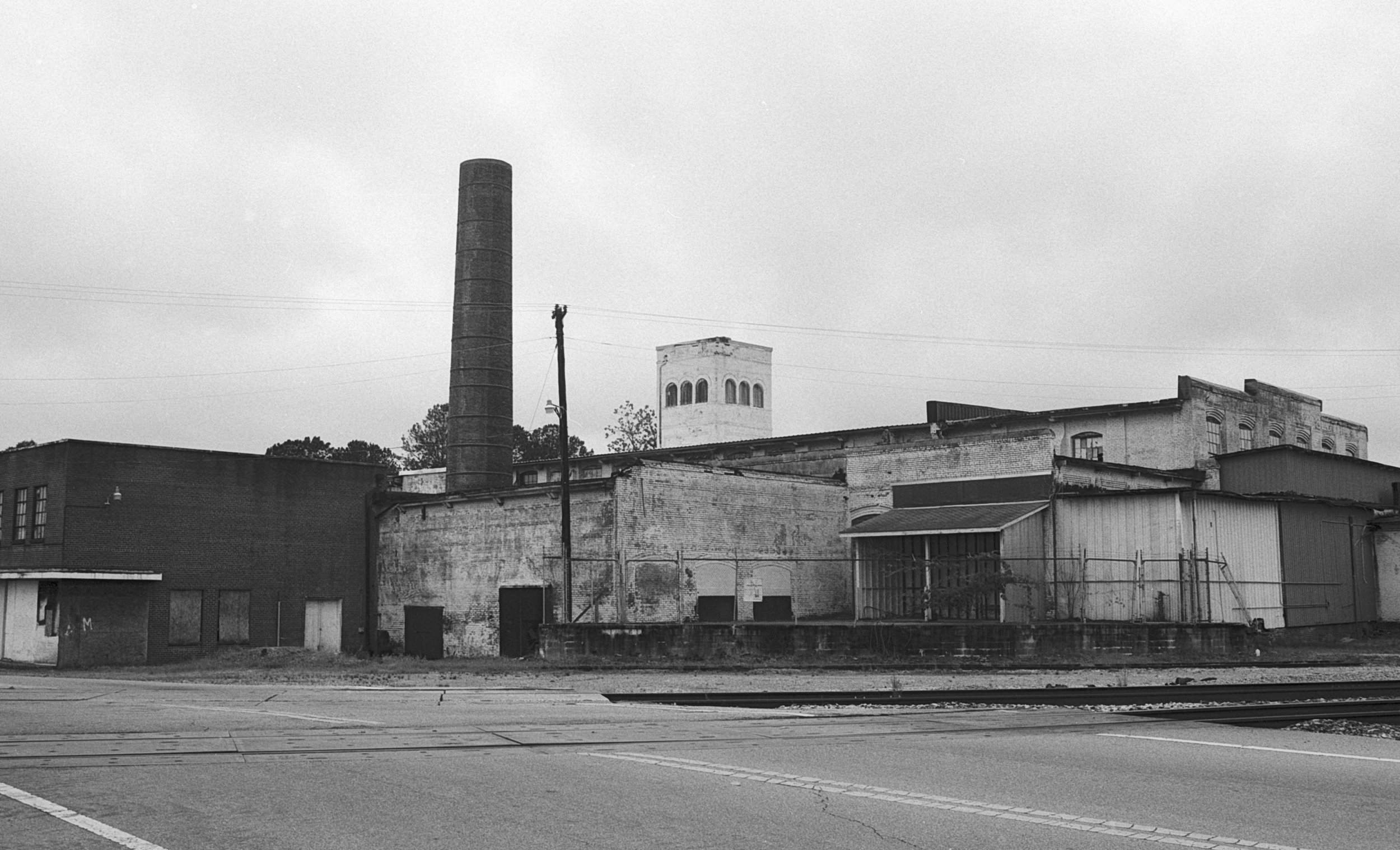
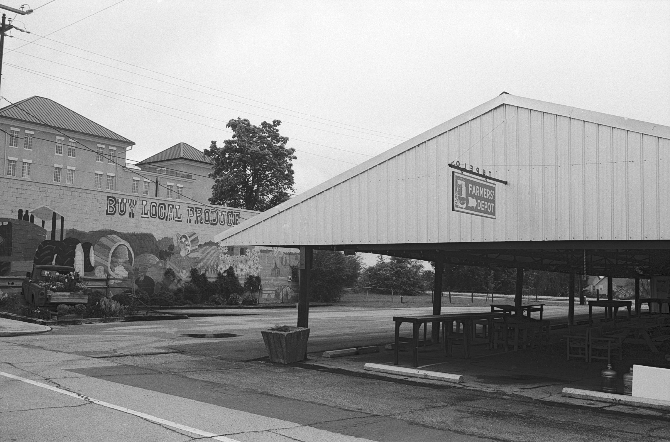
Tupelo grew up where it did because of the railroad. There's still a "station" of sorts near where the switching of railcars occurs.
Ilford Delta Professional 100 shot on a Canon AE-1 Program camera with a Canon FD 35mm f/2.8 lens.
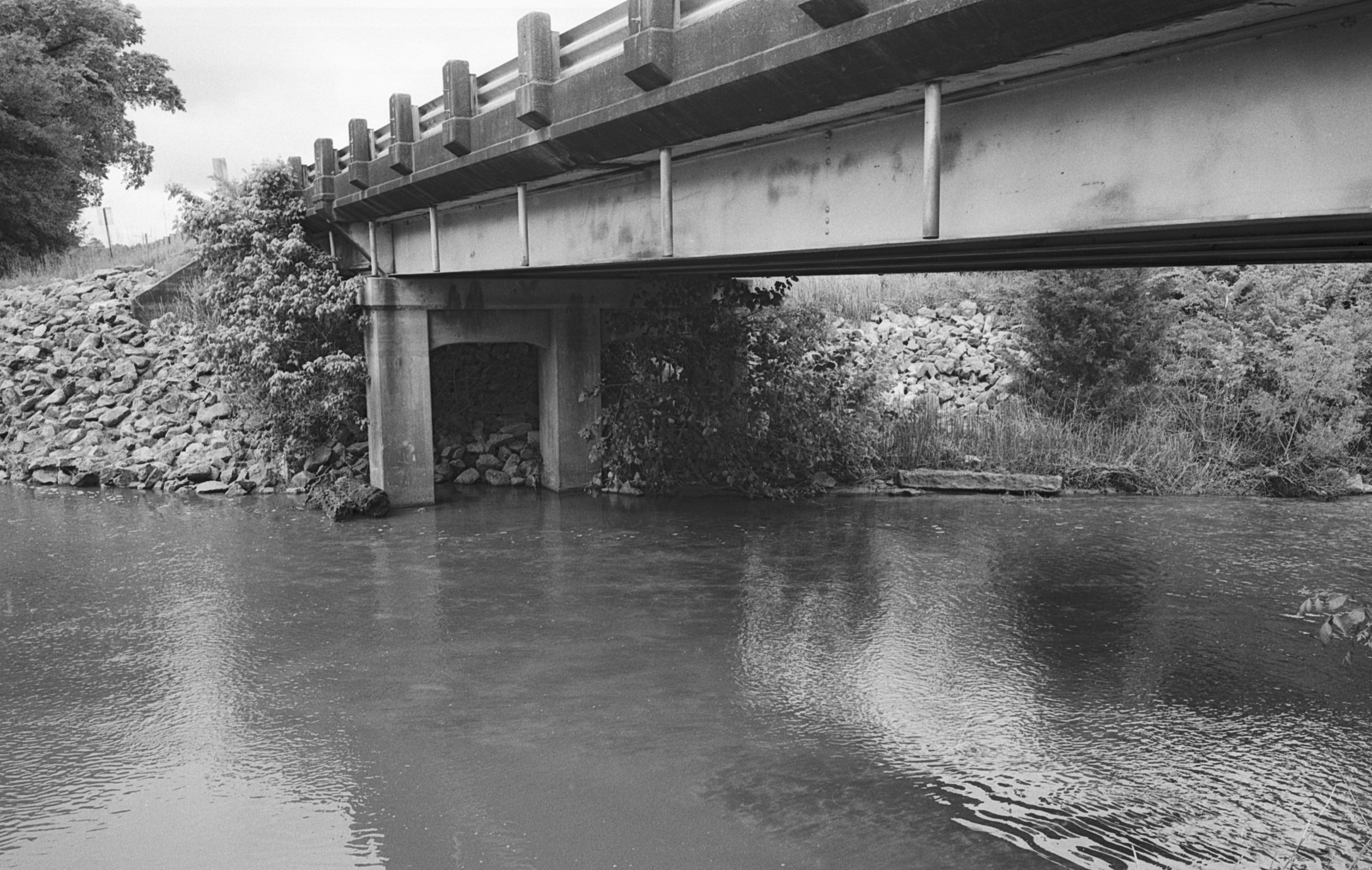
The Town Creek watershed covers most of Lee County and makes its way south into Monroe County where it joins the Tombigbee River and ultimately empties in the Gulf at Mobile, Alabama. Town Creek was once navigable all the way up to Camargo near Nettleton, Mississippi. This is the Highway 178 bridge just a couple of miles to the south and east of the source of Town Creek - the divide separates the waters that empty into the Gulf at Mobile from the waters that flow into the Mississippi River and thence to New Orleans.
Ilford Delta Professional 100 shot on a Contax G2 rangefinder camera equipped with a Contax 28mm f/2.8 Carl Zeiss Biogen *T lens.
One of the fields along Macedonia Road - prepped for soybeans or cotton - Yonaba Creek runs through this bottom near where it is joined by Camp Creek
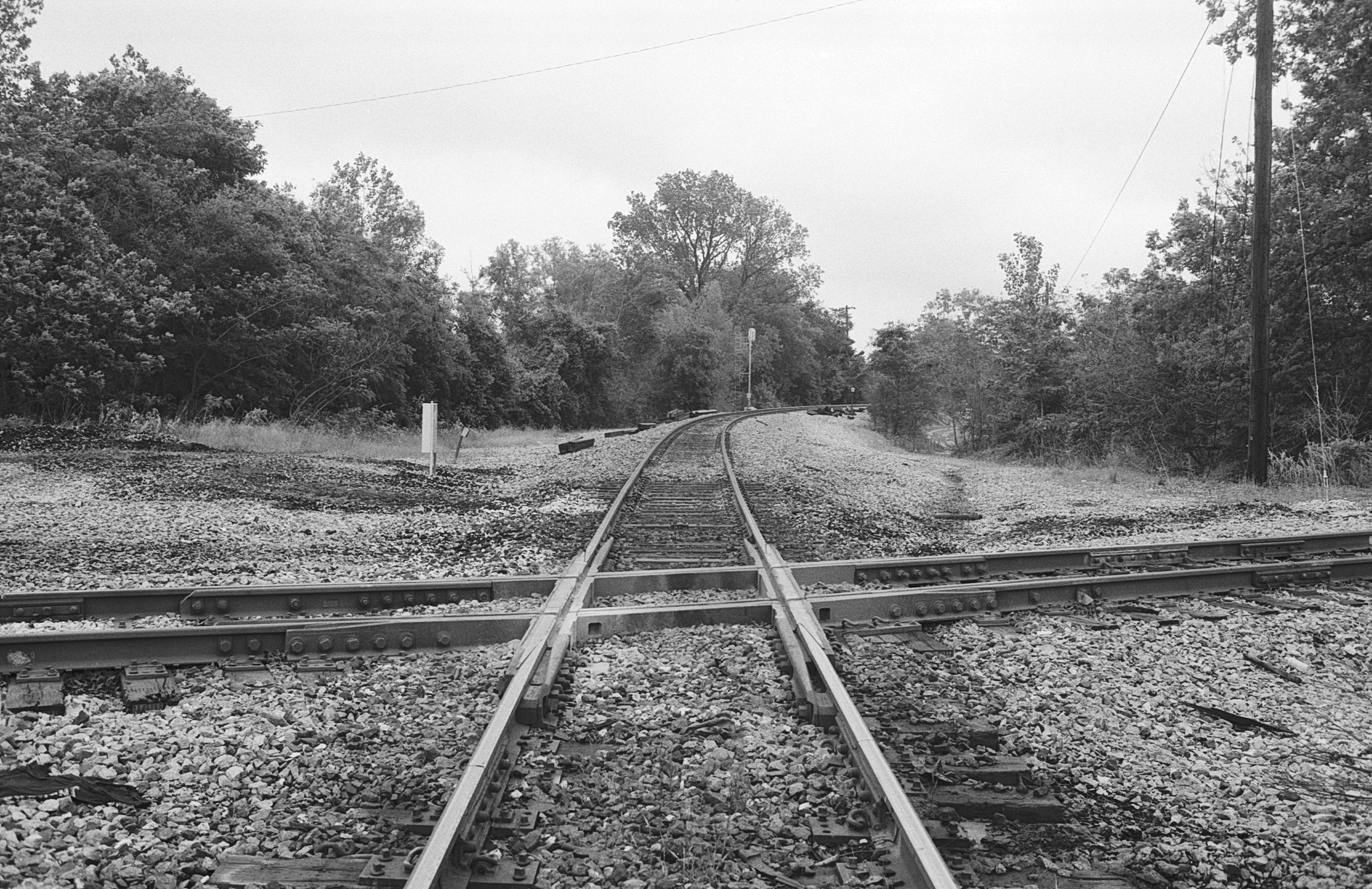
Tupelo benefitted from two railroads crossing - one running from the north and eventually to the Gulf at Mobile, the other running from Memphis to Birmingham.
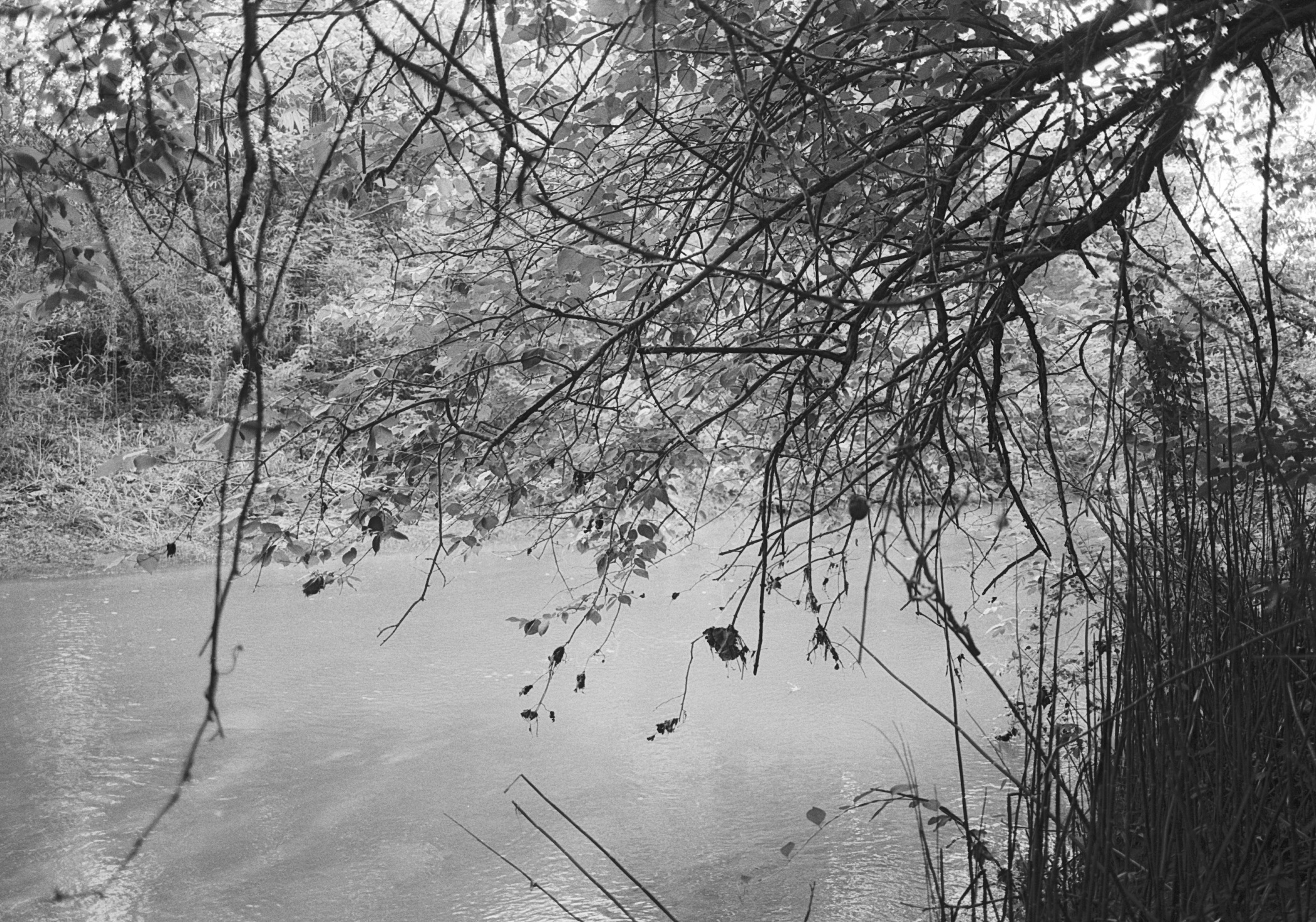
Most people don't see Town Creek except for brief glimpses at bridge crossings. Town Creek and its tributaries are lined with heavy growth of trees, vines and bushes.
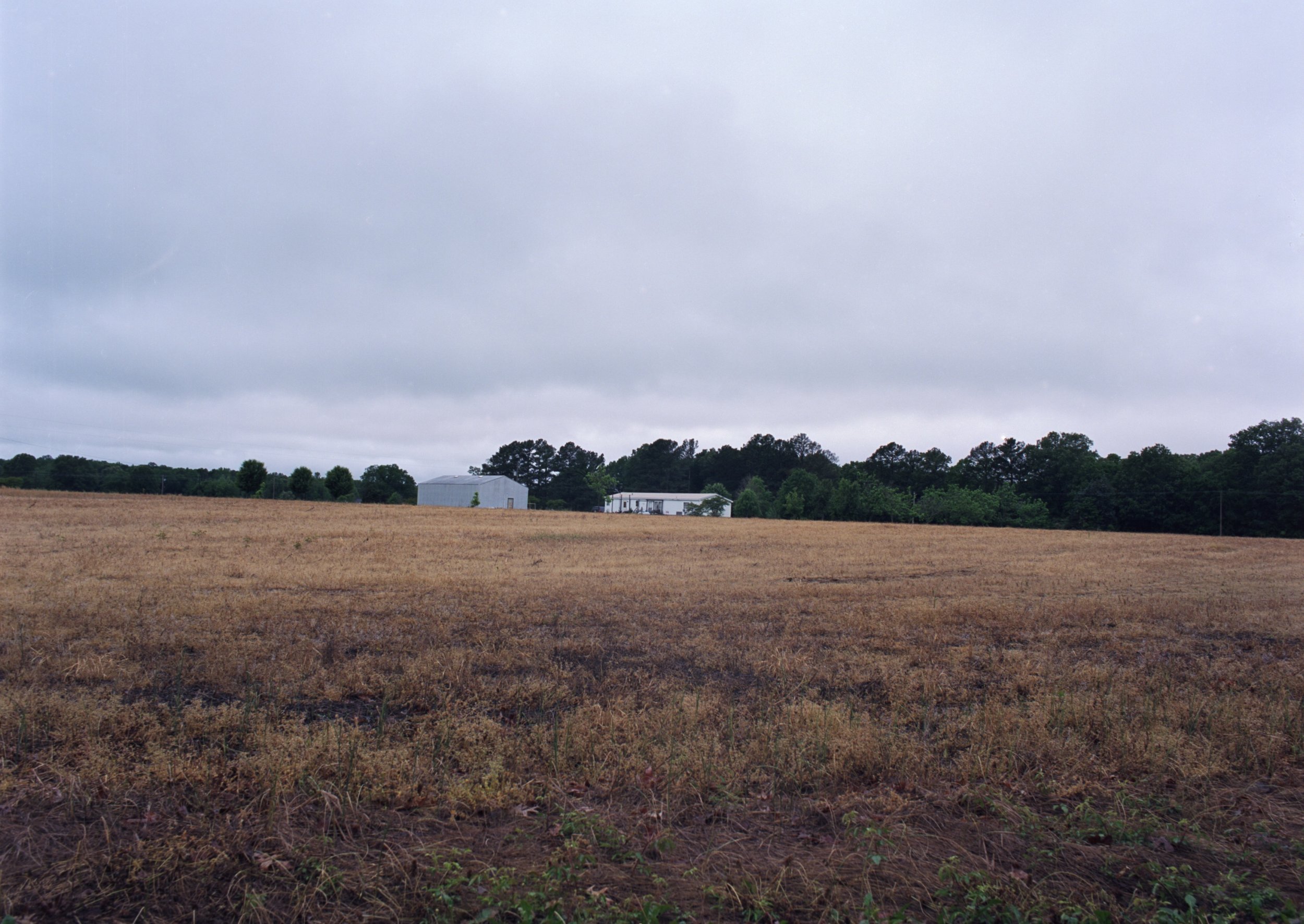
This image was captured across a field near Camp Creek, which runs near part of Birmingham Ridge Road.
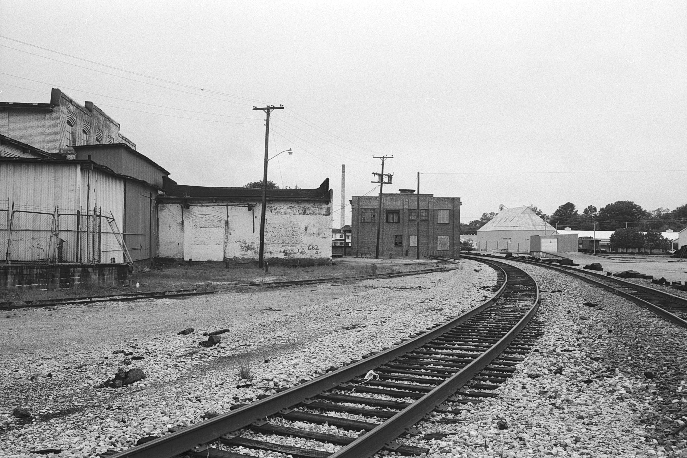
Railroads still play an important part in supplying businesses and industry, but highways have pulled a lot of the business away from the rail crossing, leaving some abandoned buildings in their wake.
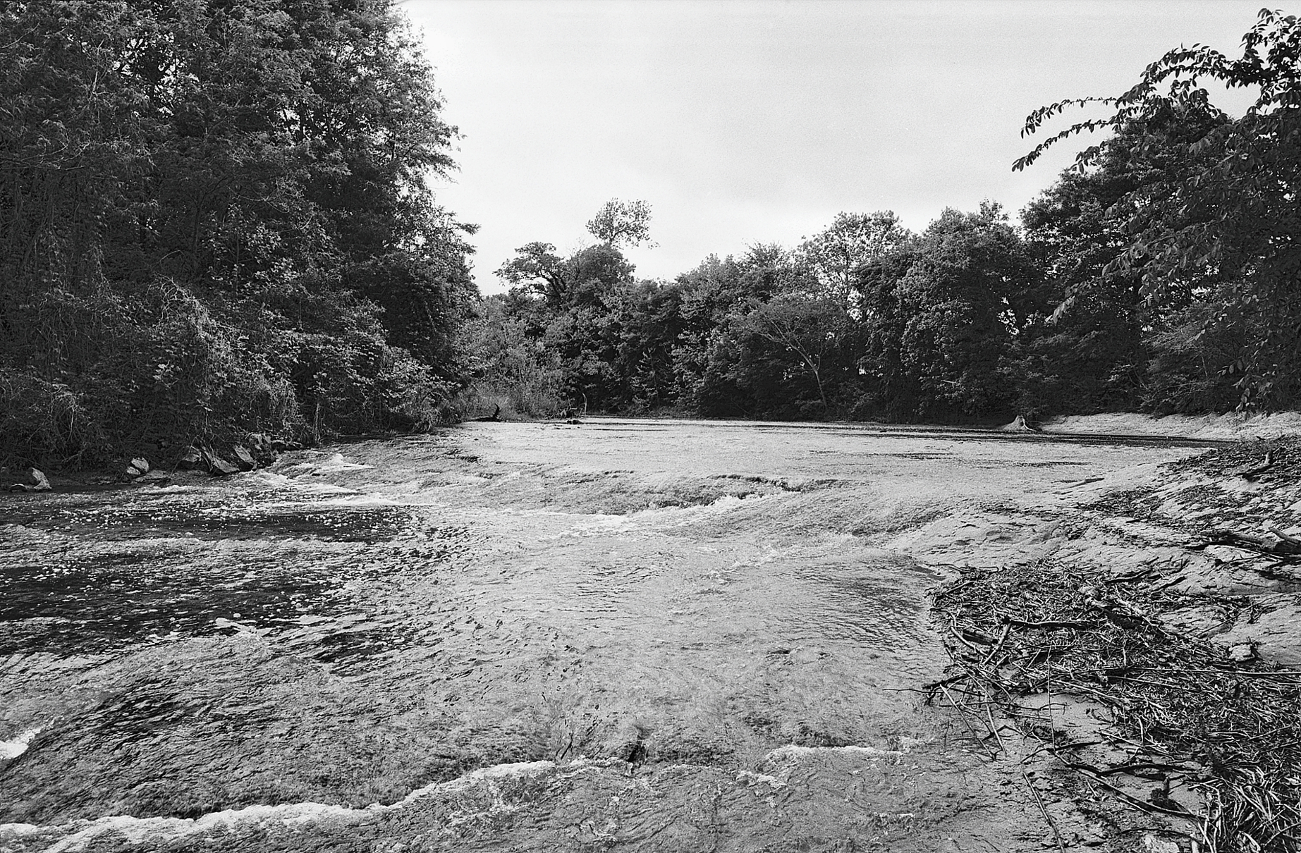
Where Highway 178 (McCullough Boulevard) crosses Town Creek the bottom consists of limestone and creates a shallow shoal that has been a good crossing place since before the highway was built.
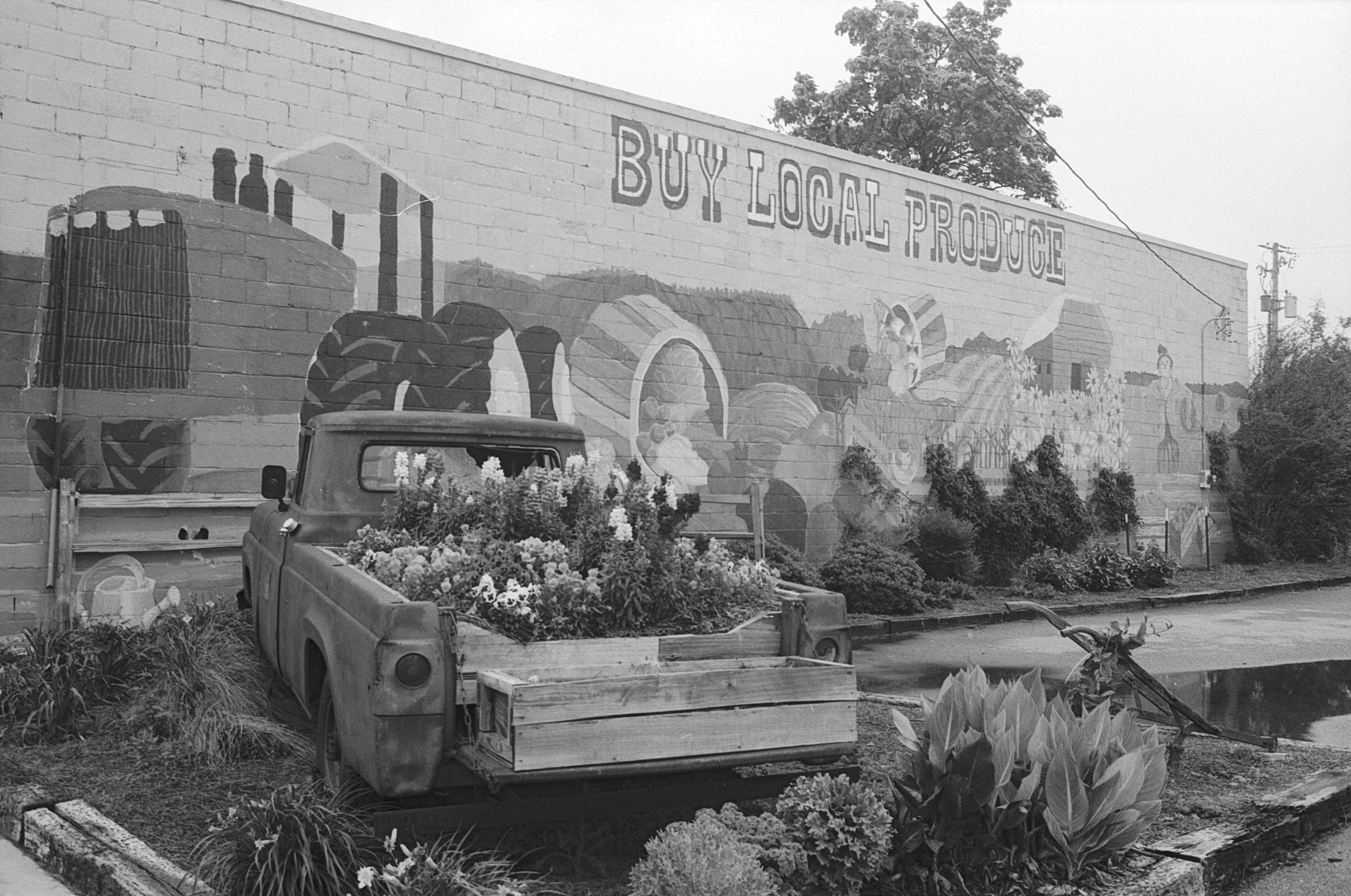
Although some businesses have moved away, the railroad crossing has been revitalized as a seasonal farmer's market. In addition, entrepreneurs have turned the old city-county building into the Belfry - an upscale, downtown residential building. On the other side of the tracks, another entrepreneur is renovating some of the old buildings with the goal of transforming them into commercial and residential mixed use spaces.
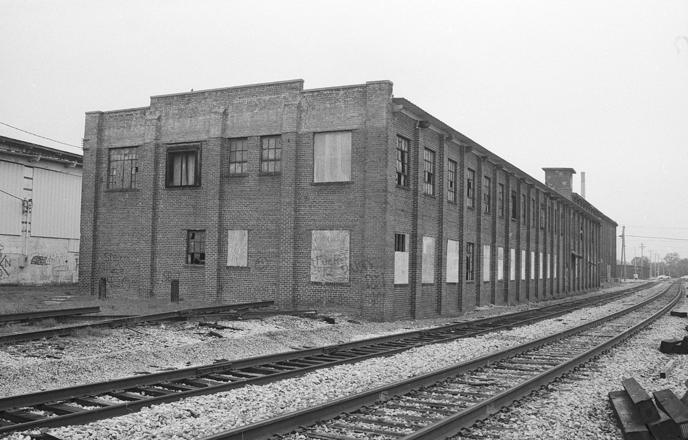
Nothing stays the same and old buildings will either be torn down or renovated. In the meantime, they make great subjects for photographers.
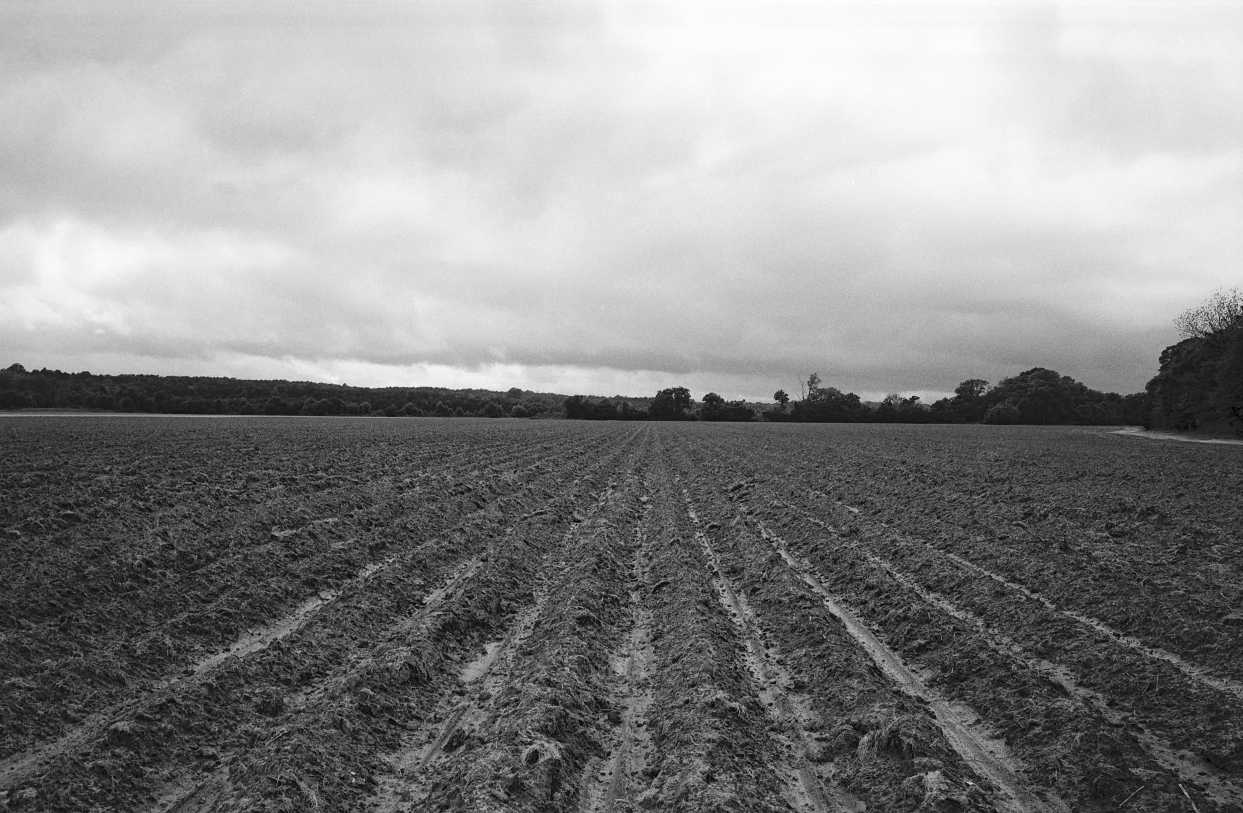
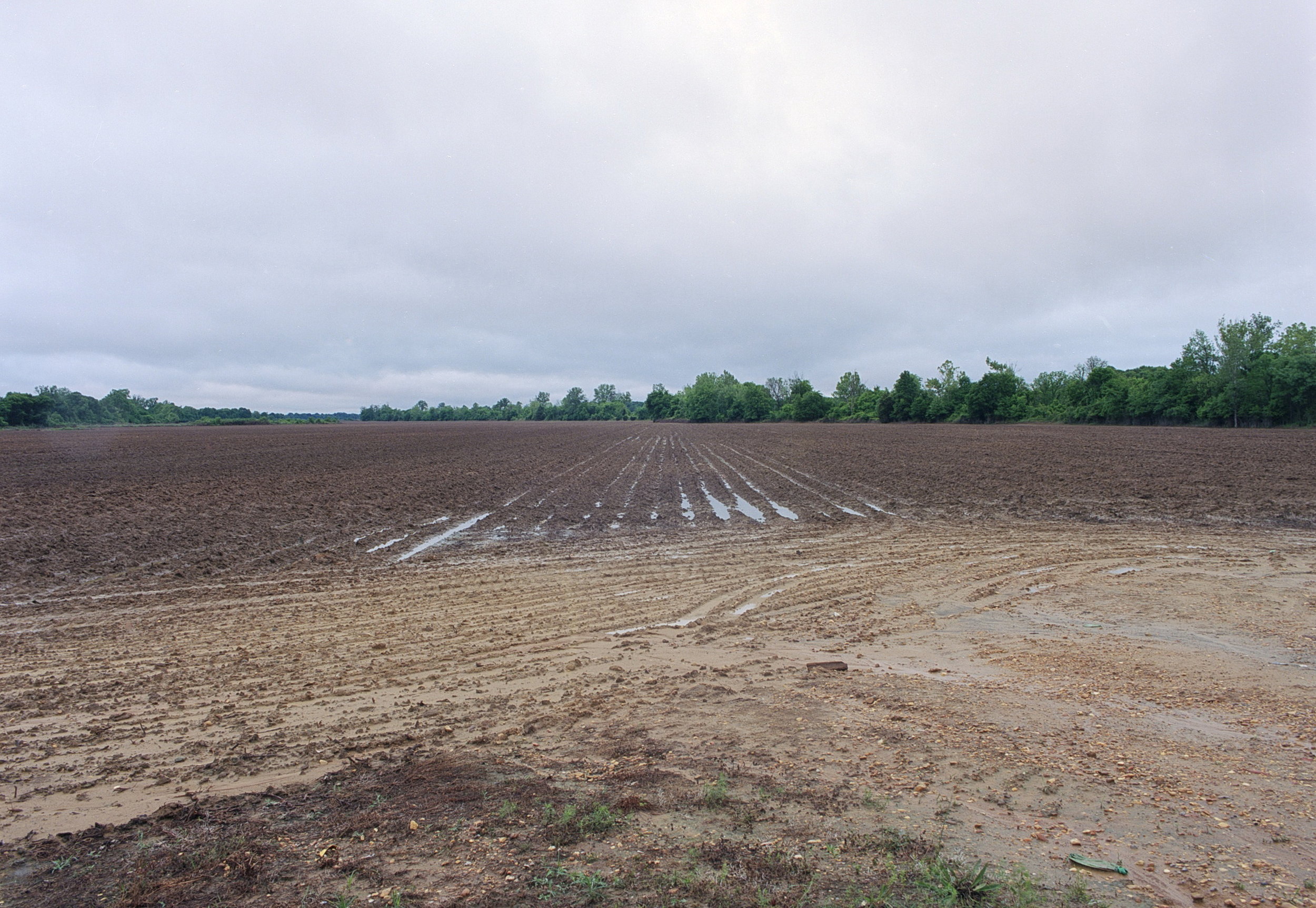
This field is just to the west of Town Creek near Highway 178. There's something about those straight furrows in a plowed field, especially after a rain, that begs to be captured on film.
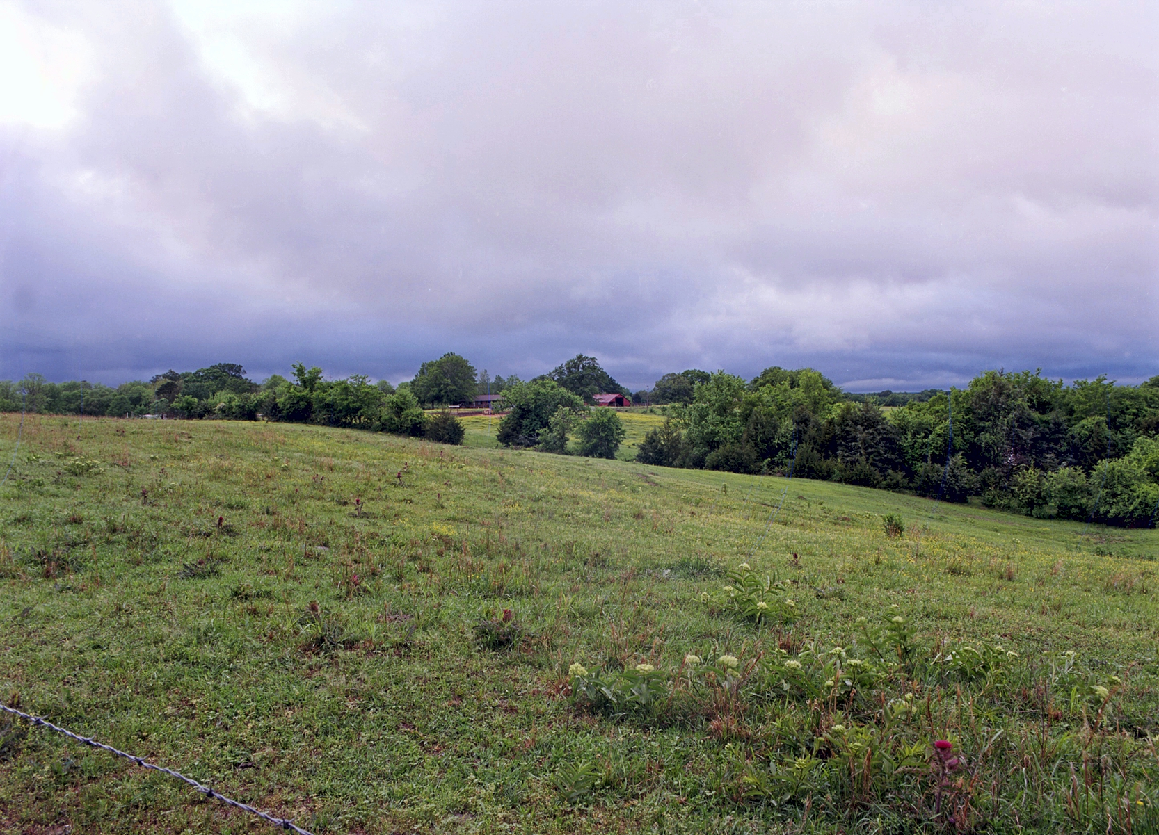
This image from beside Mt Vernon road was taken near it's terminal intersection with Macedonia Road and is the view toward the northwest. The image was shot at 1 second at f/22, allowing the barbed wire fence and thistle in the foreground to be in focus as well as the barn and tree line in the distance.
The old, abandoned buildings near the railroad crossing make for interesting rooflines.
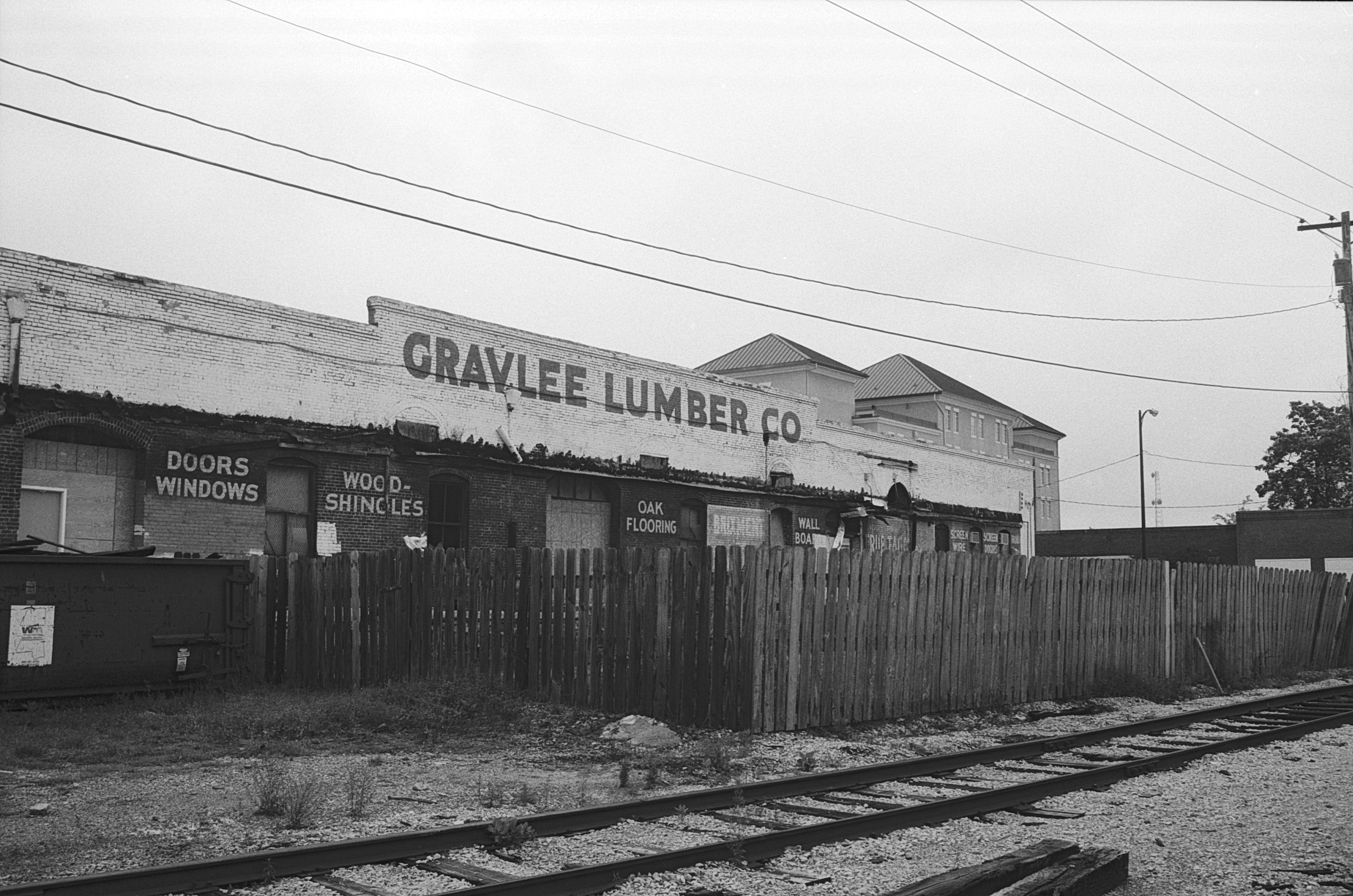
I spent many hours at Gravlee Lumber buying tools, lumber and paint for my own projects, but also for sets constructed for Tupelo Community Theatre. It's closed now, but I can still hear the saw in the back and smell fresh cut lumber, even if it's in my imagination.
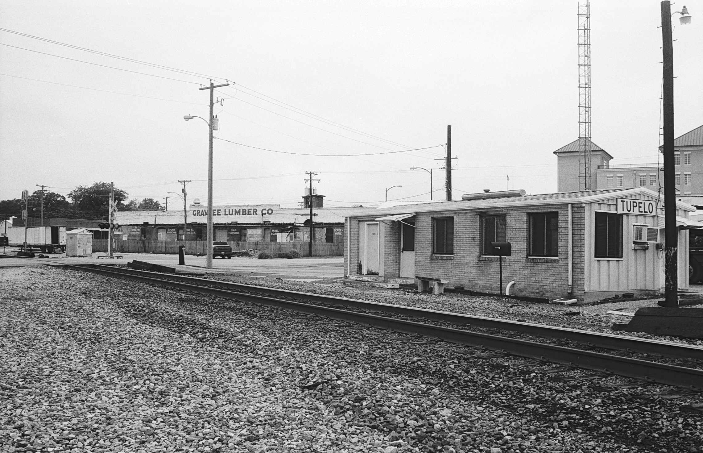
We usually think of the railway station house as viewed from Spring Street . . . I thought I'd try a couple of shots looking west across the tracks instead.
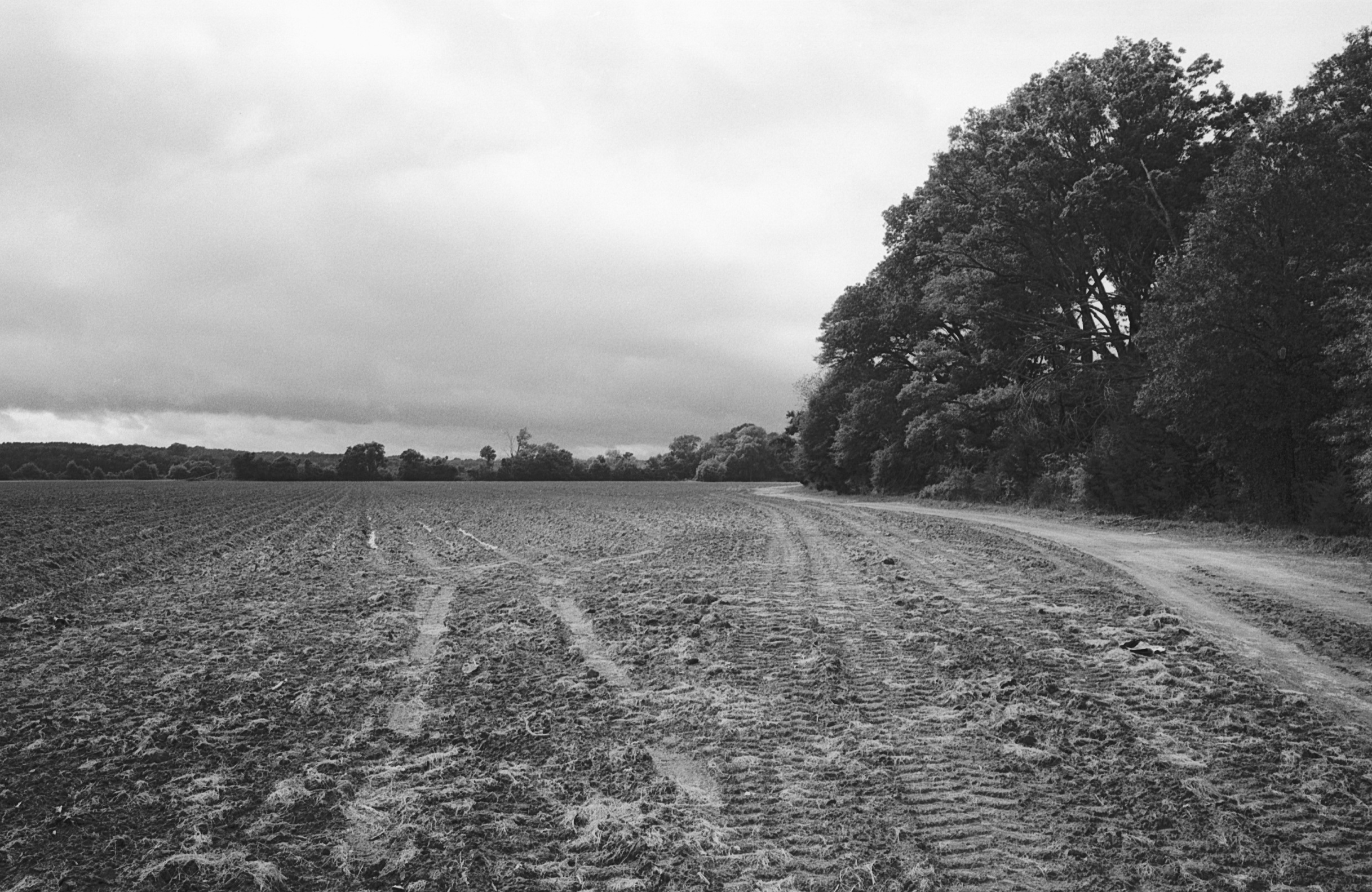
After taking the shot of the plowed field near Town Creek I shot this one looking back toward the trees that line the creek and the dirt path that borders the field. When I developed and scanned the negative, I found that that there was something I really liked about the transition from the order of the plowed field to the natural lines of the trees and shrubbery.
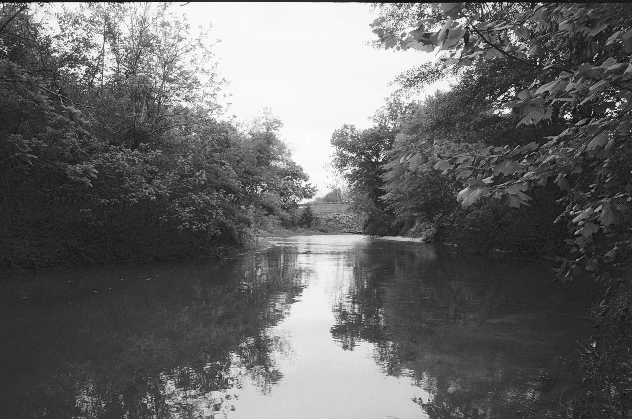
Upstream from the Highway 178 Bridge, the creek is deeper and the bottom is sandy, but with a layer of silt from farming run-off that will suck the boots right off your feet. I was just a little worried about landing in the water from sliding in the muck when I took this photo.
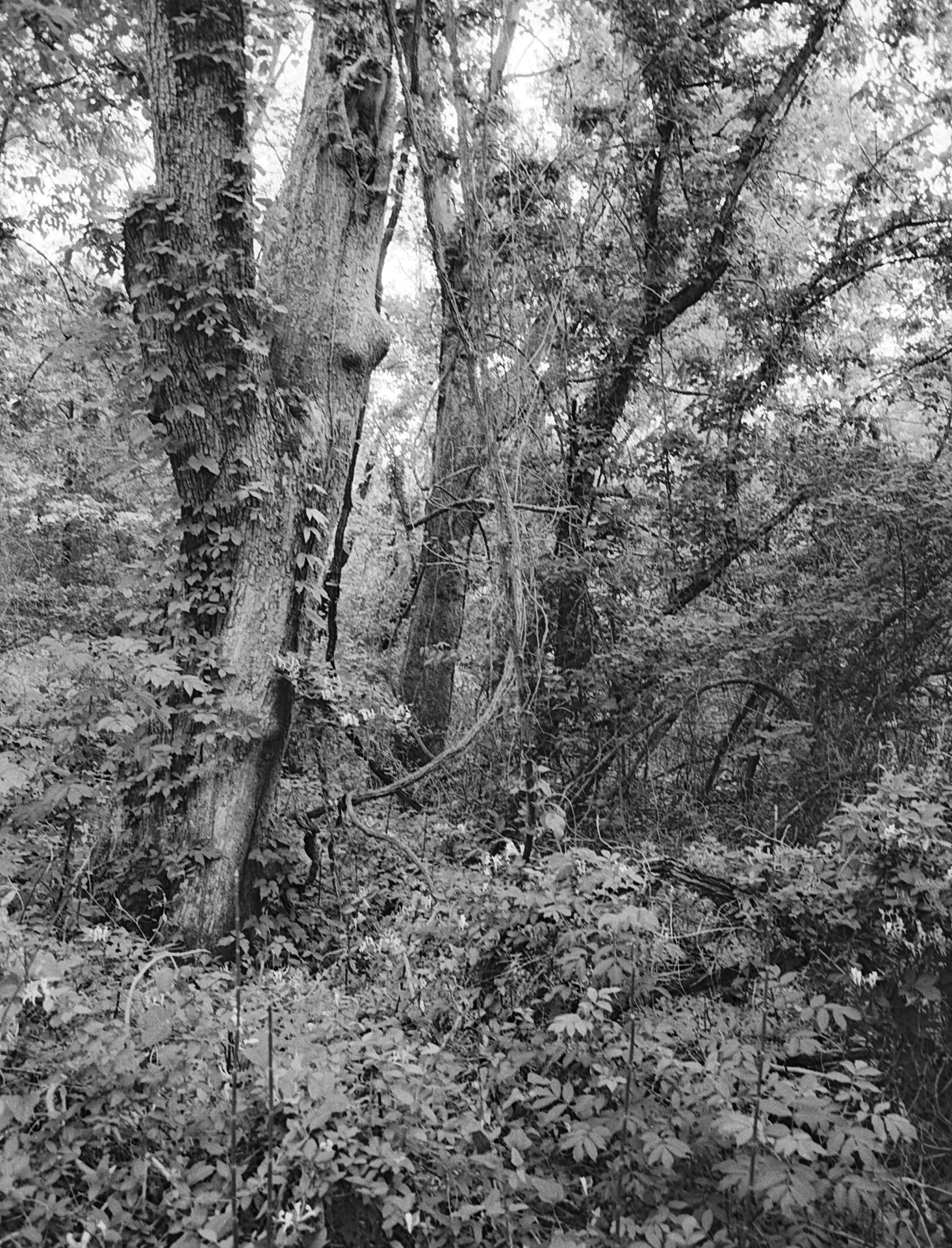
We tend to think of landscapes in terms of vistas, but this image that I captured as I hiked along the banks of Town Creek has its own charm in the tangled closeup view of trunks, leaves and vines.
I backed up to take this photo. All of the photos in this series were taken with fixed focus lenses. Sometimes it's good to zoom and compose using your feet instead of a lens.
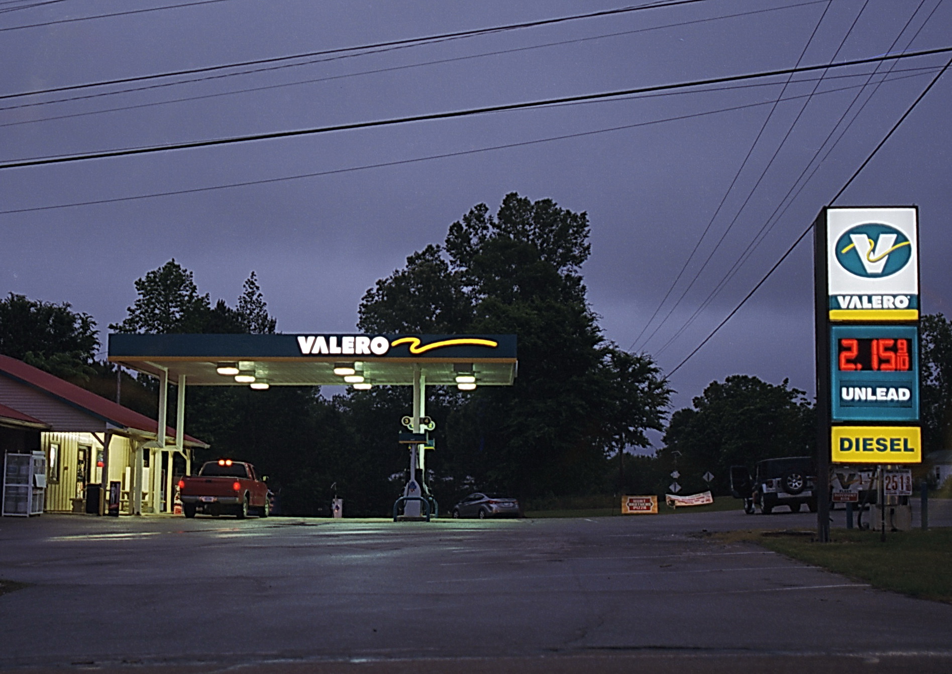
A good way to wind up shooting - contrasting a little artificial light with twilight. This is the store at the intersection of Beech Springs Road and Birmingham Ridge Road - it's recently been rebranded and given new signage. If you continue north past the store, you'll come to the remains of one of the first concrete roads in the nation.